
- An evacuation centre in the Waitaki District opened in the early hours of this morning, an evacuation centre in Mosgiel that opened overnight has now closed.
- Dunedin's civil defence bunker was activated on Sunday.
- A state of emergency was declared for Waitaki District about 5.30am on Monday.
- Coastal Dunedin and Clutha are under a red heavy rain warning until 10am Monday.
- Coastal parts of north Otago are under an orange heavy rain warning until 2pm.
- Dunedin's mayor says the council was preparing for the worst.
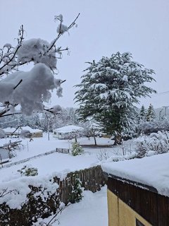
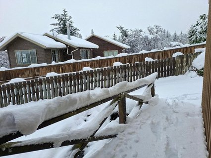
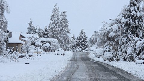
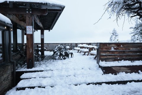
- An orange heavy snow warning is in place for Otago excluding coastal areas, and northern Southland (north of about Lumsden) until 6am Monday.
- On Monday at 4pm a heavy rain warning kicks in for Marlborough and inland Canterbury north of Lake Sumner, excluding Marlborough Sounds.
RNZ is New Zealand's statutory civil defence lifeline radio broadcaster, providing vital information and updates as they come to hand. All frequencies can be found here.
Updated Jul 5, 2026 10:42 PM
Jul 5, 2026 11:25 PM
RNZ Live
Jul 5, 2026 11:24 PM
RNZ Live
Updated Jul 5, 2026 11:29 PM
Jul 5, 2026 11:20 PM
RNZ Live
Coastal Otago under an orange warning
MetService says coastal Dunedin north of the city is under a heavy rain warning until 5pm tonight.
A further 15 to 25mm of rain is expected on top of what has already fallen.
MetService says intensities have generally decreased but maximum rates of 5 to 7 mm/h are expected.
Snow is likely above 400 metres.
There is a low chance of upgrading to a red level warning.
Jul 5, 2026 11:15 PM
RNZ Live
Waitaki mayor, controller and minister briefing to be livestreamed on RNZ
Waitaki mayor Mel Tavendale, controller Roger Cook and Emergency Management Minister Mark Mitchell will be speaking to media at the Oamaru Opera House at 12.30pm. You can watch a livestream of this on RNZ.
Jul 5, 2026 11:06 PM
RNZ Live

Jul 5, 2026 11:01 PM
RNZ Live
Jul 5, 2026 11:00 PM
RNZ Live
Jul 5, 2026 10:59 PM
RNZ Live

Jul 5, 2026 10:56 PM
RNZ Live
Jul 5, 2026 10:55 PM
RNZ Live
Jul 5, 2026 10:53 PM
RNZ Live
Adjustments to highway closures - NZTA
Some changes have been made to sections of state highway closed because of snow or flooding:
Due to flooding, State Highway 83 is now closed between State Highway 1 and Seven Mile Road in North Otago.
The State Highway 1 closure north of Oamaru now extends from Oamaru to Glenavy.
The closure of State Highway 85, Alexandra to Kyeburn, Otago, is now closed only between Becks and Kyeburn. Becks to Alexandra is now open.
8.15am, 6 July 2026 - Mosgiel road reopened
State Highway 87, Factory Road to Cargill Street, in Mosgiel has reopened after a closure because of flooding.
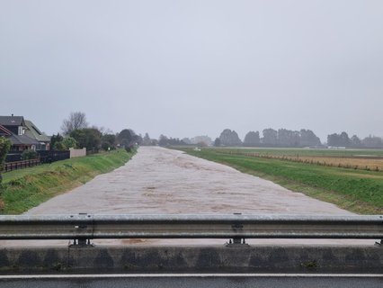
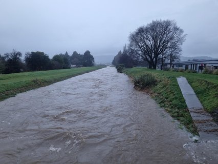
Flooding remains an issue in many parts of Otago, with a State of Emergency declared in the Waitaki District, and reports of surface flooding this morning as far north as Ashburton in Mid Canterbury. People are urged to travel with care.
Jul 5, 2026 10:52 PM
RNZ Live
University of Otago students asked to study from home
With a red heavy rain warning in place for Dunedin, the University of Otago is asking students to study from home today.
The university advised staff and students to not come to campus before 10am at the earliest.
"We're continuing to monitor conditions closely and there are currently no concerns on campus."
It said fewer people will be working on site than usual.
Jul 5, 2026 10:46 PM
RNZ Live
Dunedin City Council update
The Dunedin City Council is continuing to urge residents to stay safe and not travel unless necessary, as heavy rain overnight continues to affect the city and surrounding areas.
DCC crews and contractors have worked through the night and continue to work to address any impacts on roading and stormwater.
“With daylight, crews are out assessing any damage and identifying hazards,” says Chris Henderson, Dunedin City Emergency Management Operations Centre (EOC) Incident Controller.
“We have had significant rainfall over the past 24-hours and it is not over yet. While our stormwater network continues to work well, there is surface water in parts of the city. Fewer cars on the road means less disturbance to the water and it also means our crews can work more quickly to clear debris from streets and drains.”
Kerbside waste and recycling collection continues, but residents can expect delays due to weather.
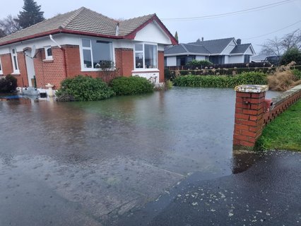
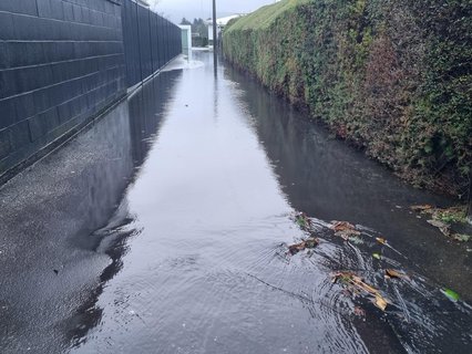
A range of roads in Mosgiel were closed overnight because of surface flooding.
On the Otago Peninsula, a down tree has blocked part of Portobello Road near Bacon Street on the Otago Peninsula. Transit is via Highcliff. No buses beyond Broad Bay at present.
Kaikorai Valley Road between Townley Road and Stone Street is closed due to flooding.
Current road conditions and unplanned road closures - Dunedin City Council
Buses schedules are impacted in some areas. Check the Orbus website Orbus - Better by bus | brought to you by Otago Regional Council (ORC).
Closures and Safety measures
An evacuation centre remains open at the Taieri Bowling Club (12 Wickliffe St, Mosgiel) overnight. A small number of people have self-evacuated.
DCC has closed Te Puna o Whakaehu (Mosgiel Pool) and Mosgiel Library today to help reduce traffic on roadways.
Sandbags are available at two sandbag stations - Mosgiel Memorial Park gym carpark (entry through Church Street) and Dunedin Ice Stadium, Victoria Road, South Dunedin) carpark.
Flood protection barriers have been installed in Surrey St, South Dunedin, and pumps and pipes in South Dunedin have managed the rainfall to date.
The Dunedin EOC continues to operate and the DCC call centre is open for anyone across the city in need of help, on 03 477 4000.
Jul 5, 2026 10:37 PM
RNZ Live
Evacuation centre in Mosgiel has closed
The evacuation centre at the Taieri Bowling Club has now closed.
Jul 5, 2026 10:36 PM
RNZ Live
Jul 5, 2026 10:35 PM
RNZ Live
Jul 5, 2026 10:32 PM
RNZ Live
Jul 5, 2026 10:30 PM
RNZ Live
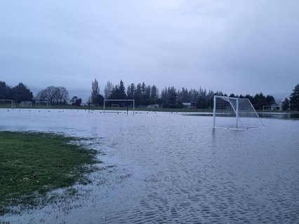
Jul 5, 2026 10:23 PM
RNZ Live
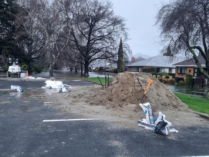
Jul 5, 2026 10:20 PM
RNZ Live
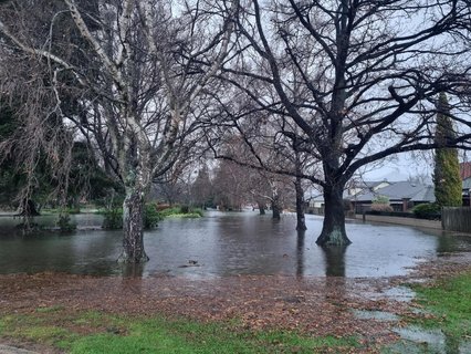
Jul 5, 2026 10:19 PM
RNZ Live
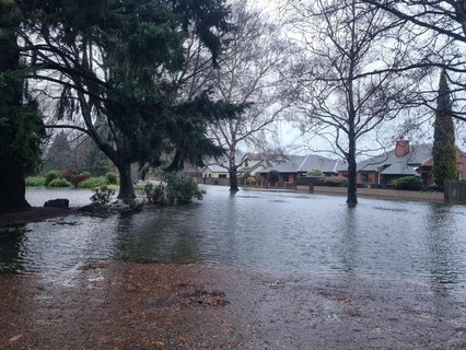
Jul 5, 2026 10:13 PM
RNZ Live
Jul 5, 2026 10:13 PM
RNZ Live
Jul 5, 2026 10:07 PM
RNZ Live
State of Emergency declared for Waitaki District as flooding impacts
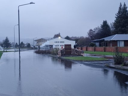
Since midnight, Fire and Emergency New Zealand has responded to over 50 emergency calls, with flood response crews assisting 18 people to evacuate to the Oamaru Fire Station.
More than 20 people chose to evacuate from their homes as flooding has affected a number of residential and commercial properties across the town.
Around 13 people and 4 dogs are currently sheltering at the Community-led Evacuation Centre at the Network Waitaki Event Centre.
Mayor Melanie Tavendale said declaring a State of Emergency ensures the resources and coordination needed are in place to support the community.
"This has been a significant localised flooding event. Our priority is the safety and wellbeing of everyone affected. We ask people to stay off the roads in affected areas, avoid floodwater, and follow the advice of emergency services."
Community-led Evacuation Centre
A Community-led Evacuation Centre has been established at the Network Waitaki Event Centre, 2 Centennial Park, Oamaru North. Access is via the Tayward Street carpark entrance.
The centre is open for anyone who needs a safe, dry place to shelter.
Small pets, including dogs and cats (contained), are welcome.
Anyone who needs assistance getting to the Evacuation Centre should contact emergency services.
Roads and travel
State Highway 1 is closed between Seven Mile Road and State Highway 83. A detour is in place and motorists should follow all signage and directions.
Council roading teams and contractors are currently assessing local roads across the district as fast as they can. Some roads may not yet be officially closed with signage but could still be unsafe or impassable. Current road closures can be found on the Waitaki District Council website.
Residents are urged to:
• Stay home in affected areas unless travel is absolutely necessary.
• Never drive through floodwater.
• Watch for slips, debris and damaged road surfaces.
• Check the NZTA website for state highway closures and the Waitaki District Council website for local road closures.
Southbound access into Oamaru remains under assessment.
Sandbags
Sandbags and sand are now available from the Eden Street car park.
Why was a State of Emergency declared now?
MetService issued a Red Heavy Rain Warning yesterday for Coastal Otago. Based on forecasting available at the time, the northern extent of the most severe rainfall was expected to remain further south.
Emergency management staff worked closely with MetService throughout the event.
Forecast guidance indicated North Otago was not expected to receive significant rainfall.
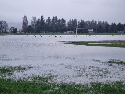
However, Oamaru experienced an intense, highly localised downpour shortly after midnight. Rainfall records show approximately 46mm fell over four hours, with 34mm falling in just two hours. This unexpected intensity resulted in rapid surface flooding across parts of the town.
As the scale and impacts of the flooding became clear overnight, a Local State of Emergency was declared to enable the necessary emergency response and support for affected residents.
Need help?
If your home is flooding, you are trapped, or your safety is at risk, call 111 immediately.
If you need to evacuate and require somewhere safe to stay, go to the Community-led Evacuation Centre at the Network Waitaki Event Centre or contact emergency services if you need assistance getting there.
If there is damage to your home or property contact your insurance provider.
The weather forecast indicates rainfall is expected to ease during the day, however authorities continue to monitor conditions closely.
The public is encouraged to monitor official Waitaki District Council and Civil Defence channels for the latest information and updates.
Jul 5, 2026 9:54 PM
RNZ Live
Clutha District Council update
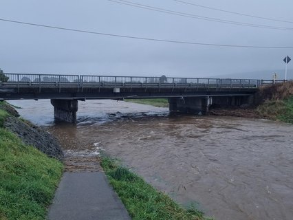
The forecasted heavy rain event overnight has affected areas throughout the Clutha District.
Our contractors are currently out assessing roads throughout the district this morning as surface flooding is present on some roads.
Motorists are urged drive to the conditions and take care in any areas where there is surface flooding.
Road update:
- Titri Road - Closed
- Back Road, Springfield Road - Surface flooding
- Tokoiti Road and Toko Mouth Road - Surface flooding
- Karoro Creek Road - Minor surface flooding
- Toko Mouth Road - Closed
- Mitchells Flat Road - Closed


0 commentaires:
Enregistrer un commentaire